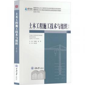
土木工程测量专业英语
出版时间:
2015-12
版次:
1
ISBN:
9787562492917
定价:
42.00
装帧:
平装
开本:
16开
纸张:
胶版纸
页数:
312页
字数:
487千字
11人买过
-
本书根据我国土木工程专业培养目标,参照国家标准规范及规程,以加强基础,注重实用为原则编写的特色英文教材。全书共分10个章节,第1章至第5章主要介绍工程测量学的基本原理和方法,包括测量误差、水准测量、角度测量及距离测量的基础知识。第6章介绍测量的坐标系统和方位角。第7章介绍控制测量。第8章介绍地形图的基本知识及测绘方法。第9章介绍放样工作。第10章介绍道路与桥梁工程测量。本书侧重基本概念与方法,强调典型工程案例分析,并注重新仪器、新方法和新技术的介绍。 本书全面而系统地介绍了国内外的测量技术,可作为土木工程专业、建筑专业、道路专业的通识教材,同时也可供相关专业的生产技术人员参考。
Chapter 1 Introduction1.1 Surveying1.2 Types of surveys1.3 Plane surveys and Geodetic surveys1.4 How to carry out surveys1.5 Characteristics of surveyingChapter 2 Measurements and Errors2.1 Errors2.2 Characteristics of accidental errors2.3 Arithmetic mean value2.4 Accuracy and precision2.5 Propagation of accidental errors2.6 Significant figures2.7 Field notes2.8 PlanningChapter 3 Levellling3.1 Datums and heights3.2 Levelling equipment3.3 Differential levelling3.4 Precision of levelling3.5 Application of levelling3.6 Errors in levelling3.7 Adjustment of levels3.8 Automatic or self—levelling level3.9 Electronic digital levelChapter 4 Angle Measurement4.1 Theory of angle measurement4.2 Theodolites4.3 Measuring horizontal angles4.4 Measuring vertical angles4.5 Errors in measuring angles4.6 Adjustment of theodolitesChapter 5 Distance Measurement5.1 Introduction5.2 Ordinary taping5.3 Precision taping5.4 Stadia surveying5.5 Electronic distance measurement5.6 7110tal station instrumentsChapter 6 Coordinate and Direction6.1 Geographic coordinate systems6.2 Plane rectangular coordinates6.3 Direction of a line6.4 Azimuth6.5 Bearing6.6 Grid azimuth calculationsChapter 7 Control Survey for Small Regions7.1 Introduction7.2 Traverse surveys7.3 Traverse fieldworks7.4 Traverse calculations7.5 Other methods in horizontal control surveys7.6 Vertical control surveysChapter 8 Detail Surveying and Mapping at Large Scale8.1 Introduction of topographic map8.2 Preparation before locating details8.3 Surveying detail using theodolites8.4 Surveying detail using total stations8.5 The Completed survey mapChapter 9 Setting Out9.1 Introduction9.2 Setting out distances.angles and elevations9.3 Setting out by coordinates9.4 Applying of setting outChapter 10 Route Surveying10.1 Introduction10.2 Center line survey10.3 Setting out a circular curve10.4 Setting out a transition curve10.5 Setting out a curve by coordinate method10.6 Setting out a vertical curves10.7 Route section survey10.8 Calculation of volumes10.9 Route construction surveyBibliography
-
内容简介:
本书根据我国土木工程专业培养目标,参照国家标准规范及规程,以加强基础,注重实用为原则编写的特色英文教材。全书共分10个章节,第1章至第5章主要介绍工程测量学的基本原理和方法,包括测量误差、水准测量、角度测量及距离测量的基础知识。第6章介绍测量的坐标系统和方位角。第7章介绍控制测量。第8章介绍地形图的基本知识及测绘方法。第9章介绍放样工作。第10章介绍道路与桥梁工程测量。本书侧重基本概念与方法,强调典型工程案例分析,并注重新仪器、新方法和新技术的介绍。 本书全面而系统地介绍了国内外的测量技术,可作为土木工程专业、建筑专业、道路专业的通识教材,同时也可供相关专业的生产技术人员参考。
-
目录:
Chapter 1 Introduction1.1 Surveying1.2 Types of surveys1.3 Plane surveys and Geodetic surveys1.4 How to carry out surveys1.5 Characteristics of surveyingChapter 2 Measurements and Errors2.1 Errors2.2 Characteristics of accidental errors2.3 Arithmetic mean value2.4 Accuracy and precision2.5 Propagation of accidental errors2.6 Significant figures2.7 Field notes2.8 PlanningChapter 3 Levellling3.1 Datums and heights3.2 Levelling equipment3.3 Differential levelling3.4 Precision of levelling3.5 Application of levelling3.6 Errors in levelling3.7 Adjustment of levels3.8 Automatic or self—levelling level3.9 Electronic digital levelChapter 4 Angle Measurement4.1 Theory of angle measurement4.2 Theodolites4.3 Measuring horizontal angles4.4 Measuring vertical angles4.5 Errors in measuring angles4.6 Adjustment of theodolitesChapter 5 Distance Measurement5.1 Introduction5.2 Ordinary taping5.3 Precision taping5.4 Stadia surveying5.5 Electronic distance measurement5.6 7110tal station instrumentsChapter 6 Coordinate and Direction6.1 Geographic coordinate systems6.2 Plane rectangular coordinates6.3 Direction of a line6.4 Azimuth6.5 Bearing6.6 Grid azimuth calculationsChapter 7 Control Survey for Small Regions7.1 Introduction7.2 Traverse surveys7.3 Traverse fieldworks7.4 Traverse calculations7.5 Other methods in horizontal control surveys7.6 Vertical control surveysChapter 8 Detail Surveying and Mapping at Large Scale8.1 Introduction of topographic map8.2 Preparation before locating details8.3 Surveying detail using theodolites8.4 Surveying detail using total stations8.5 The Completed survey mapChapter 9 Setting Out9.1 Introduction9.2 Setting out distances.angles and elevations9.3 Setting out by coordinates9.4 Applying of setting outChapter 10 Route Surveying10.1 Introduction10.2 Center line survey10.3 Setting out a circular curve10.4 Setting out a transition curve10.5 Setting out a curve by coordinate method10.6 Setting out a vertical curves10.7 Route section survey10.8 Calculation of volumes10.9 Route construction surveyBibliography
查看详情
-
八五品
山东省济南市
平均发货8小时
成功完成率93.81%
-
土木工程测量专业英语
正版二手书,图片套装请联系客服再下单,均有笔记不影响使用,无赠品、光盘、MP30002等
八五品
山东省枣庄市
平均发货9小时
成功完成率88.71%
-
土木工程测量专业英语
正版二手,均有笔记不影响使用,无赠品、光盘、MP12198等。如需购买套装书,请联系客服核实,批量上传数据有误差,套装书售后运费自理,还请见谅!
八五品
山东省枣庄市
平均发货8小时
成功完成率90.98%
-
八五品
山东省滨州市
平均发货9小时
成功完成率89.12%
-
八五品
四川省成都市
平均发货8小时
成功完成率93.57%
-
八五品
重庆市沙坪坝区
平均发货8小时
成功完成率91.4%
-
八五品
重庆市沙坪坝区
平均发货9小时
成功完成率90.7%
-
八五品
山东省滨州市
平均发货9小时
成功完成率95.13%
-
八五品
重庆市沙坪坝区
平均发货8小时
成功完成率83.04%
-
全新
北京市朝阳区
平均发货16小时
成功完成率86.87%
-
八五品
河南省新乡市
平均发货18小时
成功完成率81.13%
-
八五品
四川省成都市
平均发货8小时
成功完成率85.74%
-
八五品
-
全新
江西省吉安市
平均发货36小时
成功完成率89.78%

 占位居中
占位居中

